It was an inexorably hot summer Saturday morning in Athens. All the roads leading out of the urban area were flooded by folks surging out of the city, seeking refuge from the heat at the country’s numerous beaches. On one of those roads were we also, for the moment trapped inside the car which resembled an oven, slowly moving along with the dense traffic jam. Unlike most of the other folks, our terminal was not to be any relieving seashore, but rather one sane people should not normally think of getting to on such a torrid day: the top of a mountain.

Specifically, we were heading to Geraneia Mountains (Γεράνεια Όρη). The range is located some 100 km west of Athens, on the borders of Attica and Corinthia, and between the Saronic and the Corinthian Gulfs. Its name translates as “Mountains of the Cranes” and is owed to an ancient myth stating that Megaros, son of Zeus, was saved by the cataclysm his father bestowed upon the world after being led to these mountains by a flock of cranes. Its highest peak is known as Makryplagi and reaches an elevation of 1369 m.
We’d chosen to approach the peak from the north, starting from the village of Spata, located some 20 km after Megara, on the way to Egirouses. About 2 km after the village, at the point 38.0438-23.1527, leaves a small road to the left. That’s where we parked the car and started our hike.
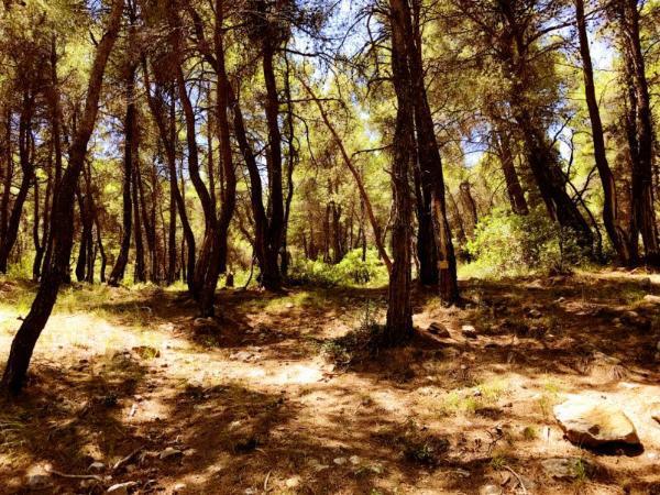
It was 1 pm by then. Only the crickets, who’d gone nuts, were interrupting the quiet. The sun was throned on the zenith of its daily course, and its violent heat assaulted the dry land and our heads felt like it was raining hammers. We’d chosen this mountain on purpose for the day, counting on it being particularly densely forested for a south Greek mountain. So, having to suffer the merciless solar hammering for a few minutes only, we soon left the road and started moving uphill under the relieving canopy of the pines, firs, oaks, and other trees that constituted this charming forest.

Having advanced for about 2 km, and gained some 400 m. of altitude, direction steady southwest along the signed path we spotted in the forest, we reached the foot of a conical bulge the mountain’s relief forms at 38.0369-23.1335. We bypassed this bulge proceeding around it from its west side and descended from its south side into the gorge which there incises the mountain.
Upon reaching the bottom of the gorge, we were met by a very pleasant surprise. The last, scanty remnants of the mountain’s water stocks were passing on their way to the sea through this narrow passage in the form of a fair streamlet. As we did not expect to find any water en route, we had planned on a very thrifty use of our supply. We exploited this unexpected gift to the utmost. It’s noteworthy how our brains’ water taste perception changes such a great deal for the better given the awareness of it being scarce.

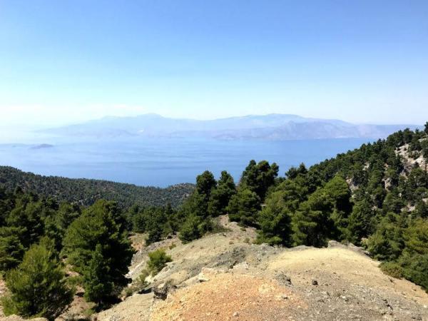
With water bottles full and souls highly reanimated, we proceeded to the last part of the ascent. Moving straight up on the still forested south face of the summit, we soon stood on the top of the Geraneia Mountain Range. Right in between of Peloponnese, Continental Greece, the Saronic, and Corinthian Gulfs, we enjoyed the epic view and the exalted feeling of occupying such a privileged outpost in the utmost… Then, the afternoon had advanced and it was time to head down again.
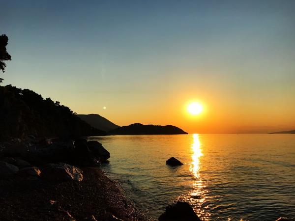
Having spent a long day of exertion, gasping, and sweating climbing a mountain amidst a severe heatwave, we’d finally made it back down to the car. It was now time to fulfill that lust which had constantly been screaming to be fulfilled throughout the day… time to go to the sea! We drove down to the coast and found an ideal little spot on a beach on the Corinthian Gulf, which bore such a rare beauty among beaches as the one diamonds bare among stones. The sun plunged behind the horizon soon after our arrival there and left the Corinthian Sea and the surrounding mountains to a cool and magical summer night.

Accommodation and Activities in Greece
Stay22 is a handy tool that lets you search for and compare stays and experiences across multiple platforms on the same neat, interactive map. Hover over the listings to see the details. Click on the top-right settings icon to adjust your preferences; switch between hotels, experiences, or restaurants; and activate clever map overlays displaying information like transit lines or concentrations of sights. Click on the Show List button for the listings to appear in a list format. Booking via this map, I will be earning a small cut of the platform's profit without you being charged any extra penny. You will be thus greatly helping me to maintain and keep enriching this website. Thanks!
