Quetzaltenango, locally called Xela (pronounced “Shay-lah”), is Guatemala’s second-largest city and a cultural hub in the western highlands. Located at over 2,300 meters (7,600 feet) above sea level, it sits in a valley surrounded by volcanoes, including the active Santa María. Historically a center of the Kʼicheʼ Maya civilization, the city blends indigenous and colonial influences, with Spanish-era churches standing alongside bustling markets and traditional Mayan textiles. Interestingly, despite its size, Xela maintains a relatively calm atmosphere compared to Guatemala City and is known for its role in education—many international students come here to study Spanish. Its cool climate and strong indigenous presence make it a unique stop for those interested in the cultural diversity of Central America.
Quetzaltenango was our first stop in Guatemala on our journey through Central America, traveling from Mexico City to Panama City. We ended up staying for about a week—and what a week it was. Our time there was filled with unforgettable moments and one-of-a-kind experiences. In this post, I’ll share stories and impressions from that sojourn, with the hope of inspiring you and helping you plan your own adventure to this fascinating corner of Guatemala.
Affiliation disclosure: By purchasing goods or services via the links contained in this post, I may be earning a small commission from the seller's profit, without you being charged any extra penny. You will be thus greatly helping me to maintain and keep enriching this website. Thanks!
Arriving in Quetzaltenango & First Impressions of Guatemala
We arrived in Quetzaltenango after a relatively short journey from the Mexican Talisman border. Even before reaching the city, we could tell we had stepped into a strikingly different world from the one we’d just left behind.
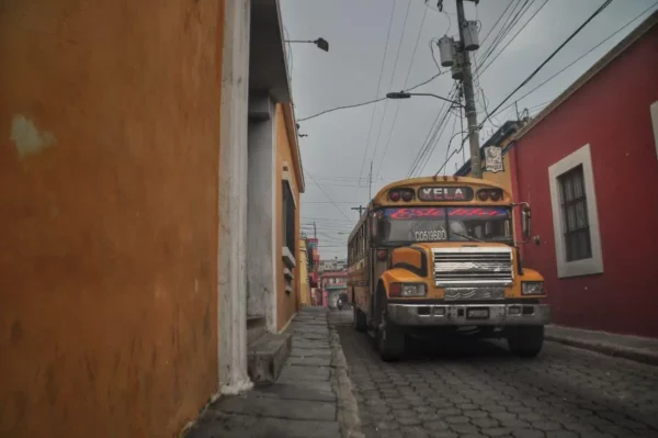
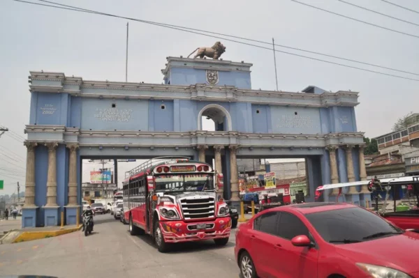
First of all, there was the transportation. In contrast to Mexico’s modern, comfortable coaches, here we traveled on those riotously painted, asthma-inducing survivors of North America’s schoolyard past known as chicken buses. They may not have the plushest seats you’ve ever ridden in, but they’re undeniably unique and far cheaper. Disappointingly, despite the name, chickens weren’t as common on board as I’d expected.
Then there was the weather and the landscape. In Oaxaca and the Valley of Mexico, we had experienced only one brief shower in two months, and the vegetation was correspondingly scarce. Here, just as we began ascending the lush, misty slopes of the Guatemalan highlands, a heavy downpour broke out—dripping inside the bus and making us worry about our possessions, which lay under a dubious tarpaulin strapped to the roof. May as it was—the start of the rainy season—the downpour would only stop intermittently for the rest of our stay in Guatemala.
Last but not least: the people. Most of the women were dressed in colorful traditional outfits; the men wore Stetsons and cowboy-era denim. Unintelligible tongues rippled throughout the bus, and later on, we’d run into folks who didn’t even understand Spanish. We felt transposed into a completely novel cultural dimension.
In the gray early afternoon, we got off at Quetzaltenango’s bus station (location)—a loose cluster of chicken buses parked along a squalid roadside—and began walking toward our accommodation.
Accommodation in Quetzaltenango
We stayed in a homestay on the northwestern working-class suburb of Colonia San Antonio. The apartment belonged to a mother and daughter from Guatemala City. As we were their very first guests, it was an absolute bargain. The hostesses seemed more interested in interacting with us than making a profit. The same friendly atmosphere prevailed throughout the neighborhood, which was completely off the tourist radar. Only the house chihuahua was initially a bit unsettled by our presence. Every time we appeared, it would launch itself into the farthest corner and tremble, the poor thing curled up in fear. But after we treated it to a little snack, it loosened up and began sleeping on our bed.
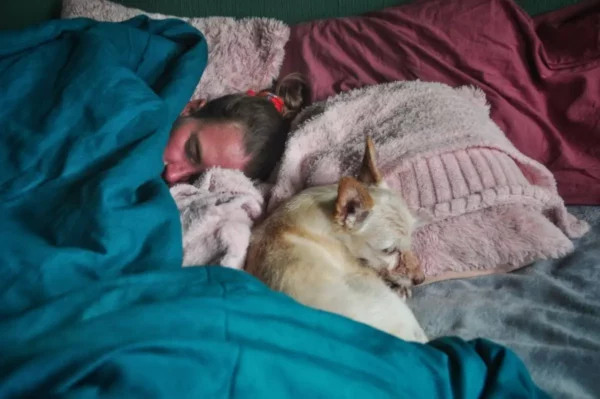
I was going to link to the place as a recommendation, but it is unfortunately no longer available.
If you’re looking for someplace central and social, Casa Kiwi Hostel is the place to be. We stopped by one evening for drinks at the terrace bar with some guys we’d met on the volcano, who happened to be staying there. Great vibes, and they even had an open music stage.
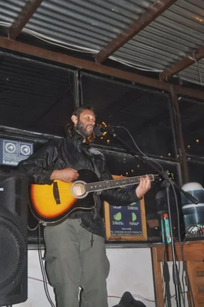
Explore more accommodation options here:
Stay22 is a handy tool that lets you search for and compare stays and experiences across multiple platforms on the same neat, interactive map. Hover over the listings to see the details. Click on the top-right settings icon to adjust your preferences; switch between hotels, experiences, or restaurants; and activate clever map overlays displaying information like transit lines or concentrations of sights. Click on the Show List button for the listings to appear in a list format. Booking via this map, I will be earning a small cut of the platform's profit without you being charged any extra penny. You will be thus greatly helping me to maintain and keep enriching this website. Thanks!
Best Places to Visit near Quetzaltenango
We had plans for several excursions using Xela as a base, but complications arose. First, we couldn’t find a vehicle. I scoured the internet, made the rounds of dealerships in person… no one was renting out motorbikes. A couple of car rental places we found wouldn’t hand over the keys without a credit card. Second, there was the weather.
Under my new umbrella—which I easily found to buy—I wasted an entire morning searching for a pair of waterproof pants. I tried clothing stores, camping gear shops, open-air markets, and malls, but couldn’t find a single pair for the life of me. The best I came across, absurdly enough, was a pair of ski pants so large that the skis of whomever they were meant to fit would have had to be made of steel just to avoid snapping. Buying them was a mistake. Even though I wore them with a belt, they soaked my legs more with sweat than the rain ever could with water.
Our most desired excursion target was the summit of Volcán Tajumulco—the highest point in Guatemala. That, however, didn’t happen, as clashes had broken out in the area between two rival cartels fighting over local smuggling routes, and the national army had blocked access. Instead, we managed two hikes up two other volcanoes:
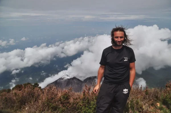
Santa María Volcano
Our hike up Santa María turned into one of the defining moments of our stay in Xela. An early start, dense fog, slippery forest trails, and a relentless climb brought us to the rim above the clouds, where the volcanic world below slowly revealed itself through shifting openings in the mist. We witnessed the restless activity of neighboring Santiaguito from above—a rare and slightly unreal vantage point. The ascent was physically demanding, atmospherically surreal, and emotionally charged in equal measure. You can read the full account of that hike here.
Lake Chicabal
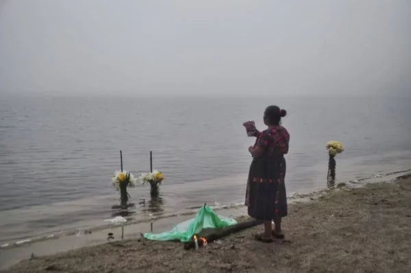
Our visit to Laguna Chicabal began as a simple day hike from Xela and turned into something much denser. A chicken bus ride and a precarious pickup lift dropped us into a throng of Mam pilgrims, and from there we climbed through drizzle and mud to the crater rim before descending the long stairway to the shore. Around the lake, dozens of small groups carried out rain-calling rituals with fires, flowers, crosses, guitars, and murmured prayers, largely indifferent to our presence. What was meant to be a quiet nature walk became an unexpectedly intimate window into contemporary Maya spirituality. You can read the full story of that day here.
These, I think, are the two must-do outings while in Xela. If you have the time, here are some more day trip destinations to consider:
San Andrés Xecul (Colorful Church)
A short ride from Xela brings you to the small town of San Andrés Xecul, famous for its vividly painted 16th-century church façade—a riot of yellows, blues, saints, jaguars, and biblical scenes compressed into one surreal surface. The town itself is quiet and resolutely local, which only heightens the shock of color when the church suddenly comes into view. It’s an easy cultural detour that fits neatly into a half-day outing.
Almolonga (The “Vegetable Basket” of Guatemala)
Just downhill from Quetzaltenango lies Almolonga, a hyper-fertile farming town whose produce supplies markets across the region. Giant cabbages, carrots, and radishes pile up in improbable abundance at roadside stalls and in the central market. It’s not a tourist attraction in the classic sense, but it offers a sharp insight into the agricultural engine that feeds the highlands.
Zunil & Fuentes Georginas Hot Springs
The town of Zunil sits in a steep valley south of Xela and serves as the gateway to Fuentes Georginas, a cluster of hot pools fed by volcanic heat. After winding through cloud forest by pickup or taxi, you soak in open-air basins with steam rising into cool mountain air. It’s one of the most straightforward ways to combine landscape, geology, and physical recovery into a single afternoon.
Salcajá (Colonial Church & Local Beer)
Often overlooked between Quetzaltenango and San Andrés Xecul, Salcajá is home to what is considered Central America’s oldest colonial church, San Jacinto (1524). Just across the street, a small local brewery claims continuity with colonial-era beer production. It’s a compact stop that blends architecture, history, and a surprisingly refined local drink culture.
Cerro El Baúl (Mirador over Xela)
The wooded hill rising directly above the city offers the most immediate nature escape from central Quetzaltenango. A short hike leads to viewpoints over the valley and surrounding volcanoes, especially atmospheric in the late afternoon when clouds drift through the basin. It’s local, unspectacular in a grand sense, but perfect for a quick reset without logistics.
Cantel & the Cement Factory Valley
Down in the narrow valley east of Xela, Cantel mixes heavy industry with sheer volcanic walls and river gorges. The contrast between raw landscape, hydro infrastructure, and tightly packed settlements is striking. It’s not beautiful in a postcard sense, but it’s one of the most visually intense close-range excursions.
Chuicavioc & the Northwestern Highlands Edge
Beyond San Antonio, the land quickly turns rural again: steep fields, footpaths, grazing animals, and fragmented hamlets. Short exploratory walks here give you highland agriculture and everyday Maya life without committing to a full mountain hike.
Inside Quetzaltenango
On account of weather and obstacles, we spent most of our week inside the city, walking extensively all over the place. Here’s how that was.
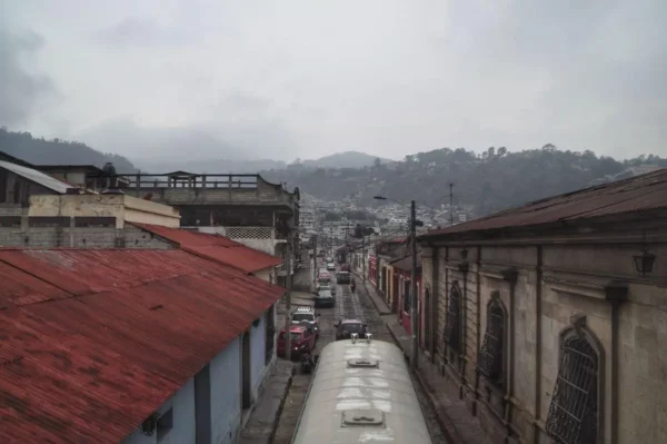
Walking through Quetzaltenango, what struck us first was the constant oscillation between color and gray. Weathered facades—turquoise, ochre, deep red—rose against a sky that never cleared, with clouds snagging on the ring of surrounding mountains. At almost every turn, volcano silhouettes hovered in the background to remind you of the terrain that encloses the city.
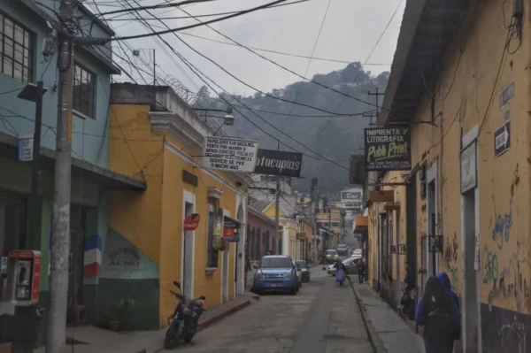
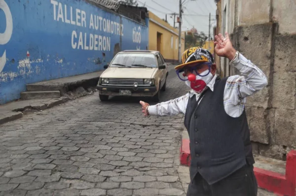
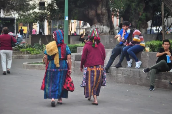
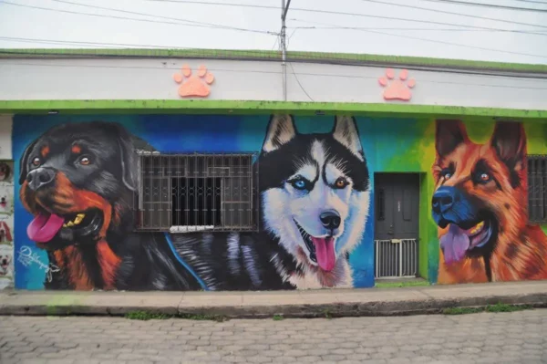
Street life unfolded at a steady, unhurried pace. Women moved through the avenues in embroidered huipiles and long skirts, their colors sharper than anything the paint on the walls could manage. Men in cowboy hats and dusty boots leaned into shop entrances or crossed intersections with practiced indifference to traffic. Vivid murals appeared where you least expected them—on utility walls, schoolyards, side streets—layered over older slogans, political traces, or half-erased religious scenes.
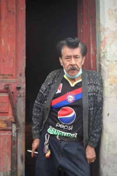
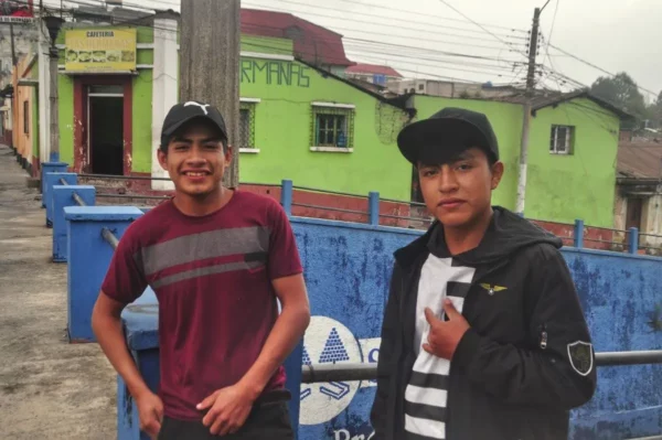
Street markets spilled into this everyday choreography almost everywhere we went. Under patched tarps and improvised awnings, vendors sold pyramids of fruit, sacks of chilies, phone chargers, plastic shoes, and second-hand clothes, while others drifted through the streets with their goods balanced on trays, carts, or their own backs.
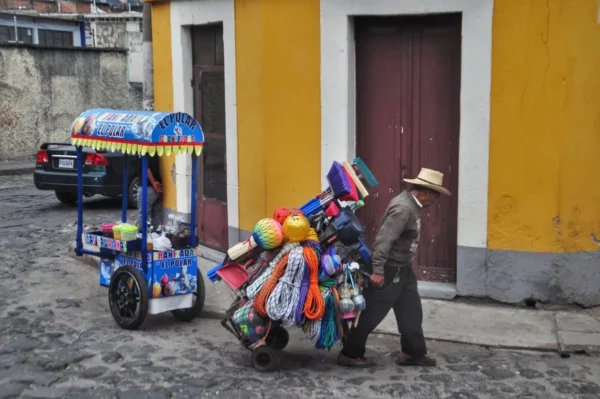
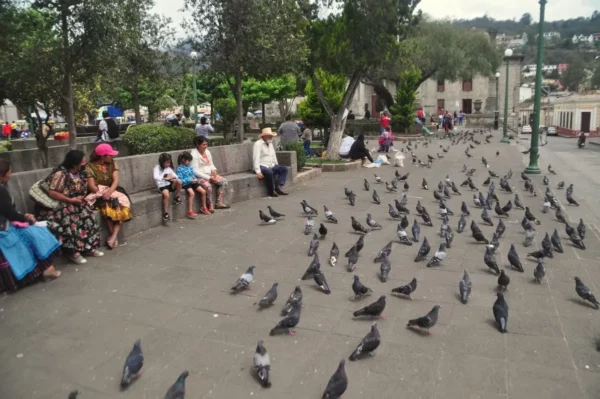
At the core of this daily motion lay Parque Centroamérica, the city’s natural point of convergence. Benches filled and emptied in rhythmic cycles, vendors threaded through the trees, and the surrounding buildings set the architectural tone of the historic center. The city hall, the cathedral, the old cafés, and arcaded façades framed the square with quiet authority, giving the space its civic gravity without overwhelming it.
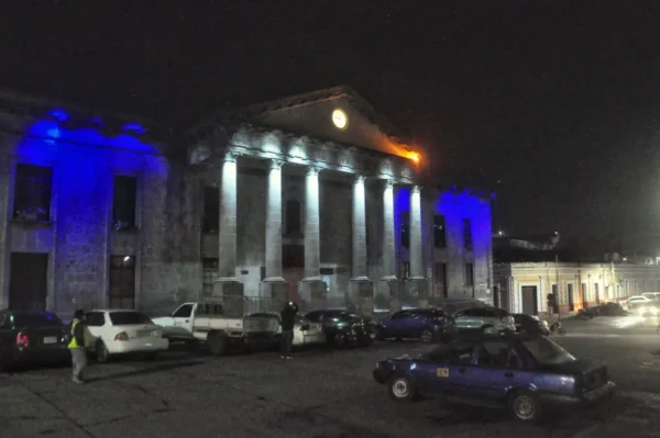
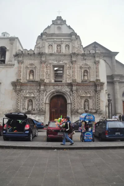
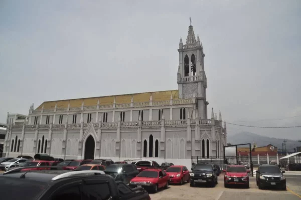
A few blocks away, the church of San Nicolás de Tolentino imposed itself through scale rather than ornament, its mass anchoring the surrounding streets. And marking one of the historic thresholds of the old city stood the Arco del Sexto Estado—less monumental than its counterparts elsewhere in Latin America, but still quietly symbolic. Together, these places formed a loose constellation that defined the structure of our walks, even when we thought we were wandering without direction.
Video
Photos
View (and feel free to use) all my photographs from Quetzaltenango in higher resolution.