The Isalo National Park, established in 1962, two years after the county’s independence, is the second-oldest national park in Madagascar. It covers 815 square kilometers (roughly half the area of greater London), ranging from 500 to 1300 meters of elevation, and is situated in the province of Fianarantsoa in the island’s south. It consists of a 250-million-year-old (five times older than the Himalayas) sandstone mountain range eroded into jagged outcrops and deep canyons run by permanent watercourses. It is inhabited by a plethora of plants and animals including six species of lemur. It became the next destination of our Madagascar road trip after leaving Ranomafana.
From Ranomafana to Isalo
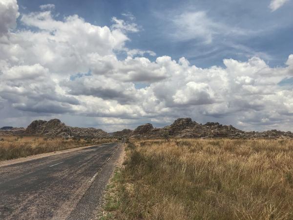
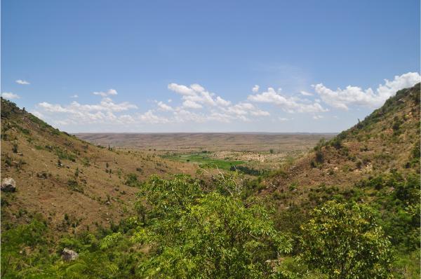
In an astounding exhibition of Madagascar’s landscape diversity, within an hour or two of our departure, the mountainous rainforest gave way to a flat desert plateau. Only odd rocky outcrops and eucalypti interrupted the horizon’s linearity. Scanty aloes broke the ground’s brown monochromy. The scenic monotony got suspended by the gigantic rock of Ifandana, a geological formation reminiscent of Australia’s Uluru. Past that, the land turned slightly more fertile, allowing meager mango orchards and shrubs that supported goats that supported small human communities. The road was overall good; it had few potholes compared to the country’s average. As it also was mostly straight, we were pretty fast to cover the 350 km from Ranomafana to Ranohira: the gateway village to Isalo National Park.
Affiliation disclosure: By purchasing goods or services via the links contained in this post, I may be earning a small commission from the seller's profit, without you being charged any extra penny. You will be thus greatly helping me to maintain and keep enriching this website. Thanks!
Accommodation in Ranohira Village
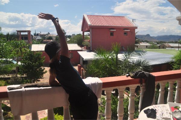
We settled in a guesthouse called Leader Hotel. At 80,000 ariary, it was a bit more expensive than what we’d been paying so far around the country but still one of the cheapest in the village. Our room was spacious and clean and had a balcony overlooking a neat garden and the Isalo Mountains in the distance. You can explore more accommodation options on the map below.
Planning the tour to Isalo National Park
Our guide (who was compulsory) for tomorrow’s hike, a jovial man dressed like Indiana Jones, came to our place to discuss the trip’s details. He introduced himself as Bienvenue. I asked him whether he was really given that name at birth or he adopted it later as his guide stage name. His English was decent but he didn’t understand this question. Anyhow, he indeed turned out a welcoming, knowledgeable, and accommodating companion for our walk. Here’s his Facebook if you want to get in touch.
Out of two circuit options, we opted for the longer one that would last 6 hours and cost 300,000 ariary: a 70,000 park ticket per person plus 140,000 total for him. He also offered to bring sandwiches for an additional 40,000 ariary per person. I don’t know if he meant to put caviar or foie gras in them, but we regardless preferred some big baguettes and boiled eggs and laughing cow from the local shop for a fraction of the cost. Our morning rendezvous set, we had a coffee on the balcony and went out at dusk for a stroll and dinner.
A walk around Ranohira
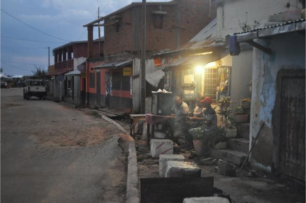
Ranohira was a typical, one-street African village. A church and the guides’ guild office were the only buildings that stood out. Despite the national park’s popularity, it wasn’t developed above average and, save guesthouse owners, no one seemed employed in the tourism sector (selling souvenirs, offering tours, catering Western cuisine, begging from whites, etc). Simple and slow-paced, I found it an agreeable place where people minded their own business and attended to you only with smiles and discreet curiosity.
For food, we chose one out of a limited range of practically identical restaurants. The menu was the dish of the day: rice, beans, pork. By pork wasn’t implied pork meat but pork fat, skin, and bone. I ate as much as I could without getting cloyed, and to Sophie’s contentment, I gave the rest to the dogs that salivated outside.
Ranohira Photo Gallery
View (and if you want use) all my photographs from Ranohira.
Isalo National Park Hike
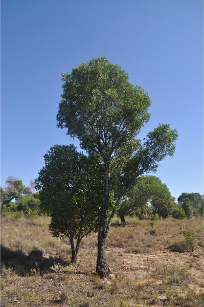
We left at 8 am, and after a quarter-hour’s sandy drive, we were at the trailhead. Our driver left to go wait for us at the route’s conclusion point, and we began on the initial, steep part of the trail up the rock’s face. Sparse mango and tapia trees grew out of the rock and sand. The latter is endemic to the central highlands of Madagascar and is distinguished for its fire-resistant wood and its sweet-and-sour fruits that we kept plucking throughout the day. Batches of purple catharanthus flowers, which are known to treat leukaemia, added a tinge of vibrancy to the landscape. The horizon kept expanding farther over the immense plains below as we gained height. It then went out of sight as we stepped over a col and onto an alien, amphitheatric plateau.
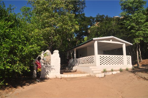
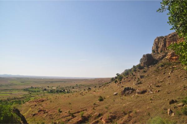
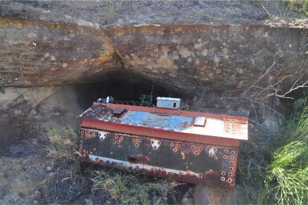
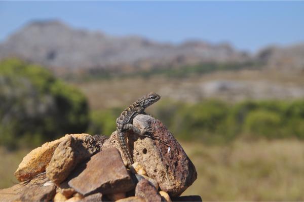
At the passage, we saw the first of a few caves where the native Bara people temporarily place their dead. I don’t say bury because the elaborate wooden coffins were in open view. After a period of mourning, they exhume them during an annual festival and put the remains in smaller cavities higher on the cliffs. Besides coffins, the only manmade things we saw up there were: 1) a tiny stone hovel built centuries ago by the aboriginal Sakalava people who used to inhabit the area before the Baras came from mainland Africa and pushed them north; and 2) scattered cairns that the tribesfolks piled up a stone for a wish at a time, kinda like the coins in the Trevi fountain. I doubt whether the effort paid them off in realized dreams, but it definitely benefited the lizards that used the cairn topstones as vantage points.
Other than those, there was only unwrought nature: outlandish sandstone formations and isolated clusters of tapia and asteropeia trees, which are also endemic to Madagascar. Lichens tapestried the rock surfaces with patterns of orange, yellow, grey, and black. The color range signified their age from young to dead. Bee-eaters fluttered between treetops, adding fills to the constant background of the cicadas’ song that resounded out of the groves.
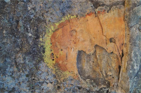
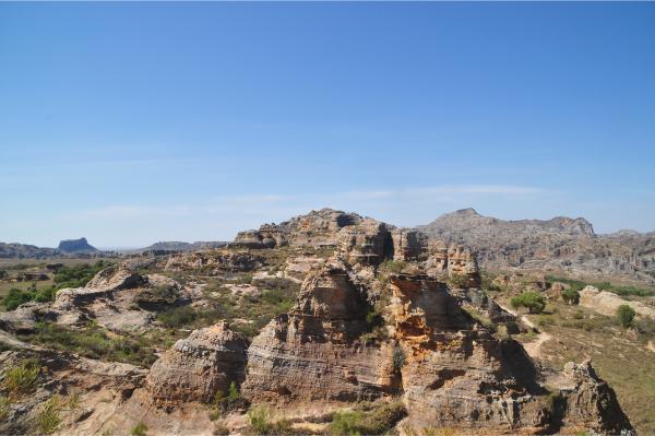
Our first stop was at a viewpoint named Petit Nazareth. Positioned atop a prominent rock in the center of the plateau, it offered a panoramic view to fully appreciate the uniqueness of the landscape. Below the rock, there was a high concentration of aloes and other plants. They were probably tended to by the park’s personnel, and that’s why Bienvenue called them a botanical garden.
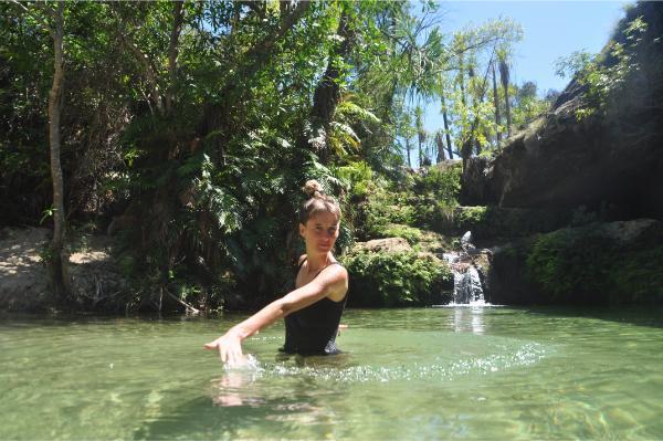
Next, we proceeded down through a gully and into a depression that held a clear natural pool and a little waterfall. The pool shore was covered by fine sand and shaded by tall pandanus trees. The spot was a heavenly oasis. We stopped there for a dip and some rest. There also was a cliff along the one side of the pool, but the water was too shallow to jump in. We were soon joined by a German father-and-daughter pair and one more couple, who together with their guides were the only people we saw on the plateau.
We then hiked for some two hours straight across the entire plateau and down a deep canyon off its northern end. At the bottom ran a river hemmed in thick vegetation that the locals aptly called the petite jungle. Within it lay the campsite of Namaza. A number of locals were present: some park officials who checked our tickets, a dude with a cool box selling drinks, and a couple more guys who must have been the ones preparing the 40,000-ariary sandwiches. They had bedecked two tables and now waited idly for the arrival of the other tourist groups.
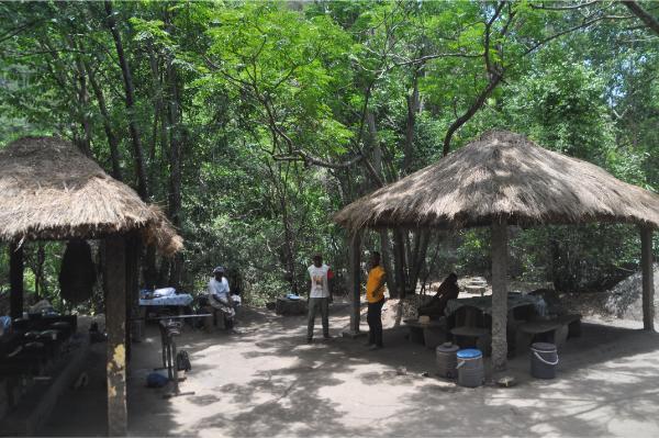
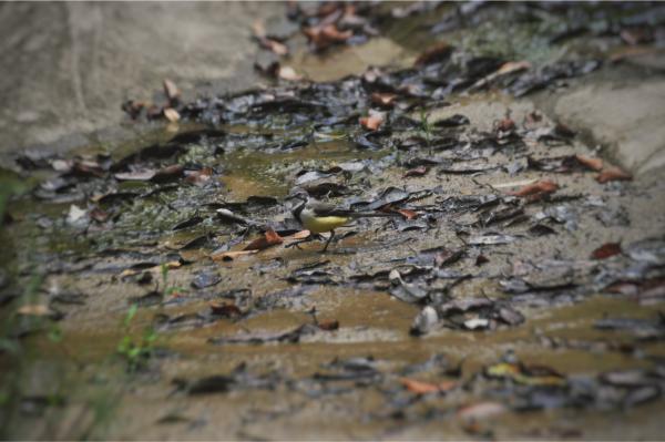
As we had brought our own sandwiches, we left Bienvenue chatting with his friends and went to eat by the river. Attracted by the falling breadcrumbs, a pair of yellow-bellied little birds soon joined us. Sophie hurled a big piece of bread their way, but it didn’t land at a safe enough distance. They made some tentative forays to reach it, but our slightest motion would send them flinging away. They preferred to get it in peace after we left.
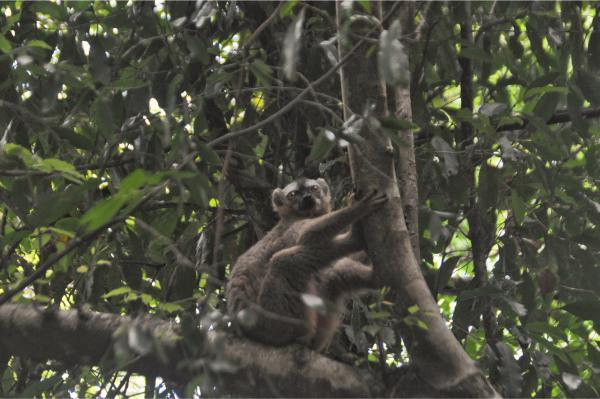
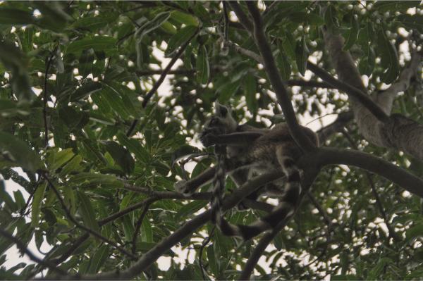
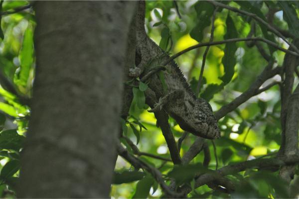
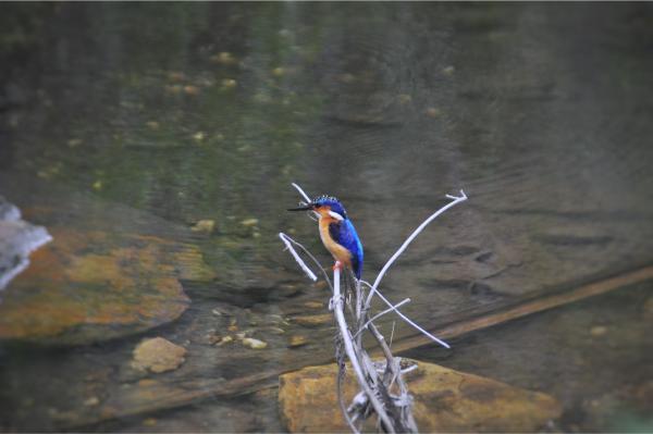
We continued on the last leg of our hike up the gorge. This route was more frequented by visitors on shorter trips. We encountered several groups on the way. The trail first went through a wooded area where we saw two lemur species (red-fronted brown lemurs and ring-tailed lemurs) and two chameleons resting on, and camouflaged in the color of, tree branches. It then followed the river where we got a kingfisher flitting the way along with us. A sudden downpour briefly joined the drops that constantly trickled down the mossy cliffs as we approached the end.
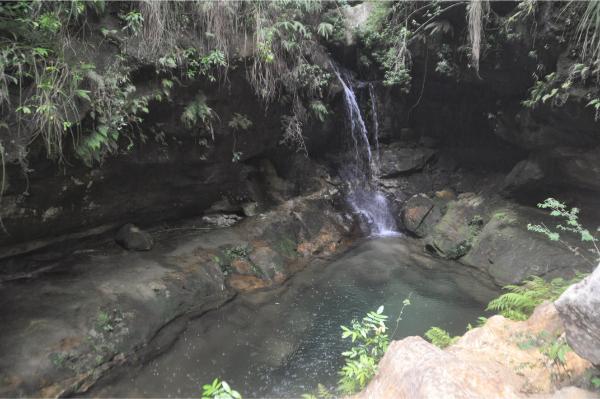
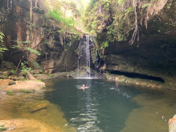
We finished at a paradisal location with two pools in a casing of tall, vertical cliffs. They were called the blue and the black pool, owing to their respective water color. The black one was black because its bottom was invisible. It’s a pity we didn’t have enough time to attempt a climb for a good cliff jump. We only stayed for a quick dip and headed back.
A bit after the campsite, we met our driver waiting in the parking. We returned to the village and spent the day chilling before continuing our road trip to Tulear in the morning.
Isalo National Park Photo Gallery
View (and if you want use) all my photographs from Isalo National Park.
For this road trip we were sorted out by Patrick from MadaRentalACR. He fixed for us a flawless and comfortable 4x4 together with the driver for the most reasonable price we were able to find and he was overall very helpful and accommodating. Our driver, Tahina, was very professional and an excellent company during our two-week wandering. You may contact him on Facebook if you're looking for a trustful driver/guide in Madagascar.
Accommodation and Activities in Madagascar
Stay22 is a handy tool that lets you search for and compare stays and experiences across multiple platforms on the same neat, interactive map. Hover over the listings to see the details. Click on the top-right settings icon to adjust your preferences; switch between hotels, experiences, or restaurants; and activate clever map overlays displaying information like transit lines or concentrations of sights. Click on the Show List button for the listings to appear in a list format. Booking via this map, I will be earning a small cut of the platform's profit without you being charged any extra penny. You will be thus greatly helping me to maintain and keep enriching this website. Thanks!
