Acatenango and Volcán de Fuego are two neighboring stratovolcanoes located in southern Guatemala, just outside the colonial city of Antigua. Acatenango, standing at around 3,976 meters (13,045 feet), is a dormant volcano popular with trekkers who often camp near its summit to witness the dramatic eruptions of the adjacent Volcán de Fuego. This is one of Central America’s most active volcanoes, regularly spewing ash and lava and creating a rare opportunity to safely observe volcanic activity from a close distance. The hike up Acatenango is rather demanding due to altitude and steep terrain, while night temperatures can drop below freezing at the summit. While Fuego occasionally poses risks to nearby communities, its constant rumbling has also made it a fixture of local mythology and a tourist magnet.
During our weeklong sojourn in Antigua, these twin volcanoes became the obvious target for a hiking adventure. We followed the classic route—trekking from the northern foot of Acatenango to its southern face, camping opposite Fuego for the night, and returning in the morning via Acatenango’s summit—but we did it independently, the two of us, without a guide or much planning. In this post, I’ll share our trip report along with all the useful info and tips you might need to recreate this excursion on your own.

Affiliation disclosure: By purchasing goods or services via the links contained in this post, I may be earning a small commission from the seller's profit, without you being charged any extra penny. You will be thus greatly helping me to maintain and keep enriching this website. Thanks!
Do You Need a Guide to Hike Volcán Acatenango?
As I’ve already made clear, no. You are permitted to hike Acatenango without a guide. The remaining question is whether you should. Most people prefer to join guided tours. Out of several dozen hikers we saw during the trip, I didn’t notice anybody else on their own.
For those who do choose to hike Acatenango without a guide, the main reason is usually to cut costs. The savings aren’t massive, but still something. Let’s break down what you’ll spend either way.
Acatenango DIY Hike: Costs & Gear
Going independently, you’ll pay:
- Entrance fee: Q100 (≈ $13) per person. When we did the trip in 2022, it was Q50, but they apparently have doubled it now. Not 100% sure though.
- Transport from Antigua: around $20 each way by Uber, or less than $2 by chicken bus. On our way back, since no Uber would come and a passing car stopped before any bus showed up, we hitchhiked. So that’s also an option if you’re up to it.
- Camping fee. We paid Q40 (≈ $5) in 2022 after negotiations. There is no official rate. You just have to strike a deal with the people from the tour agencies’ camps. You could theoretically avoid it by camping alone away from the camps, but good luck with finding level ground. We tried. All but impossible.
- Food
So, count on a bare minimum of $20 per person if you’re traveling by chicken bus and sticking to cheap supermarket food. That’s assuming, of course, you’ve got your own camping gear and don’t need to rent anything. The absolute essentials are:
- tent
- sleeping bag
- warm, waterproof clothing
- torch
Additionally, you probably also need cooking gear and gas (unless you’re fine with cold food) and perhaps walking poles (personally, I never use them).
Acatenango Guided Tours: Costs & Amenities
Organized tours to Acatenango (from Antigua) start at around $45, while they average around $80 and go upwards of $150. All of them include transportation (often with hotel pick-up), food, and accommodation of corresponding quality. Most tours also provide all necessary gear, including clothing. The lower-end ones typically don’t cover the entrance fee. Aside from convenience, another good reason to join a tour is the company, especially if you’re traveling alone. Here are some options if you want to check them out:
Hiking Acatenango: Difficulty & Safety
Besides costs and amenities, you might also be wondering about safety when deciding whether to hire a guide. Good news: as long as you have at least minimal hiking experience, there’s really nothing to worry about.
In terms of both technical difficulty and human-related risks, Acatenango is an easy hike. The trail is well-maintained and straightforward—you’d have to try to get lost. While it’s steep in places, there’s no need to use your hands at any point.
Thanks to its popularity, the trail is constantly trafficked by other hikers and regularly patrolled by military police. Unlike many other mountains in Guatemala, there are no documented cases of armed robberies on Acatenango.
Ultimately, it’s your call. In our case, while money was a factor, we chose to go without a guide mainly out of habit—trekking solo is just what I’ve always done, often in places so remote they lack not only guides, but any human presence at all.
Our Acatenango Hike Story
Getting from Antigua to the Trailhead
While Sophie worked a morning shift on her laptop, I enjoyed my coffee in the grassy inner yard of the colonial house we were calling home in Antigua—a lovely, quiet guesthouse you might want to check out if you’re looking for budget-friendly accommodation in the area. She wrapped up by 9 a.m., and after some final preparations, we stepped out into the sunny morning around 10, striding through the historic town’s cobbled streets toward the bus station.
As you can tell, our plan was to take a chicken bus to the Acatenango trailhead. These depart from Antigua’s main terminal (located here). In hindsight, not our best idea.

It took us 20 minutes to reach the station and another 10 to spot the bus. Then we waited for over an hour inside the bus for it to get full, and about half an hour more until we left the station, as the driver drove a few meters at a time and stopped to gab with his friend. I was relieved when we passed the gate, and then exasperated when, three blocks down the road, he stopped again, stepped off, and disappeared from view.
Having had enough and preferring to hike in daylight, we got off and called an Uber. It turned up before long, and at last, we left Antigua. If you’re also planning to take a taxi, it’d be a good idea to arrange a pickup for the return trip with the same driver. We didn’t, and as I mentioned earlier, we couldn’t find anyone willing to drive out there through the app afterward.
The weather took a sharp turn as we began rounding the sharp curves up the mountains. Thick fog rolled in, and heavy rain began pounding the lush landscape. As if God were doing us a favor, the downpour stopped almost concurrently with our reaching the trailhead about an hour later.
The Hike to the Camp
The trailhead is located here, along the main road near the village of La Soledad. Even though we arrived at a rather late hour, many other hikers were assembled there, shuttled on comfortable tourist vans. We put our waterproofs on and set off walking up the slope through the drizzle.
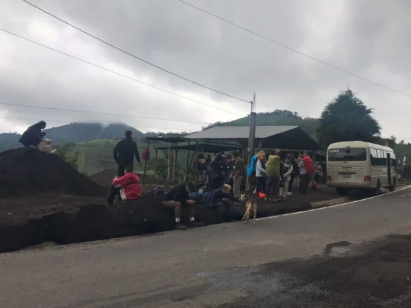
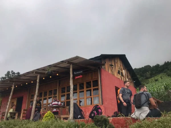
We first cut through the expansive cornfields that blanket the northern foot of Acatenango. In about a kilometer, we reached a kind of visitor center that featured a restaurant, some info boards, and the ticket booth. After paying for our entrance, we proceeded into the jungle.
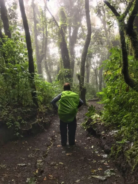
The first half of the route was a steady, leg-burning climb. The trail was often slick with mud, winding its way through thick vegetation and gnarled tree roots. Mist clung to the canopy above, and the forest felt almost enchanted, with every surface coated in moss and ferns thriving in the cool damp. The sheer density of greenness felt like a living painting. Toiling my way uphill, I steamed constantly with evaporating sweat, like a walking volcano.
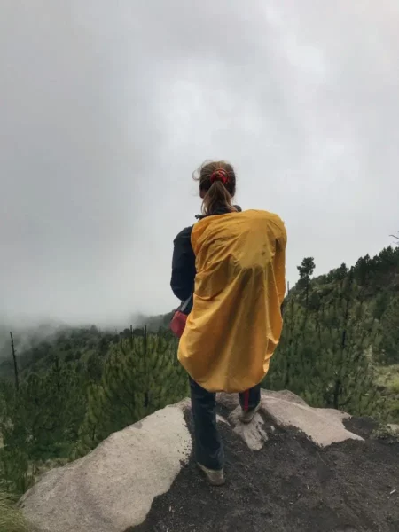
After stopping for lunch about halfway, the second half was very different. The incline became gentler, with fewer roots and less mud to trip over. The fog began to thin. The jungle gave way to sparser vegetation, dominated by tall, slender conifers. We passed open clearings offering sweeping views of the otherworldly slope. If it hadn’t still been cloudy, we would’ve been seeing the surrounding mountains and valleys. The air felt cooler, the landscape wider, and the mood lighter as we pushed on toward the camp.
Camping opposite Volcán del Fuego
In the late afternoon—about five hours since we’d started trekking—we rounded the southern contour of Acatenango. And then, through the shifting clouds, emerged the crater of Volcán del Fuego.
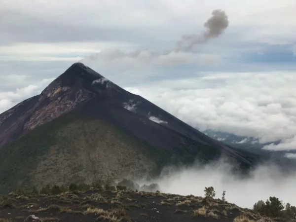
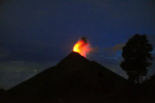
I had seen erupting volcanoes before, but none rivaled this one in sheer spectacle. With a muffled roar, it would every so often spit a column of black smoke into the white vapor of the atmosphere. A faint crackling pierced the silence as volcanic sputum rose and dissolved into the air, scattering pyroclastic gravel like hail over the brittle slope.
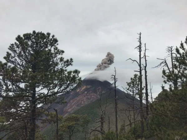
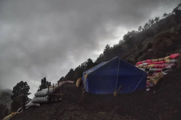
Facing this extravaganza of nature, on the flank of Acatenango, tour companies had carved out leveled platforms held in place by sack walls. These terraces hosted large, semi-permanent canvas tents along with other installations like makeshift toilets and even a swing. We had a look around, but there wasn’t a single patch of flat ground anywhere in sight. So, we ended up paying a token fee of Q40 to one of the guides to secure a spot for the night on their grounds.
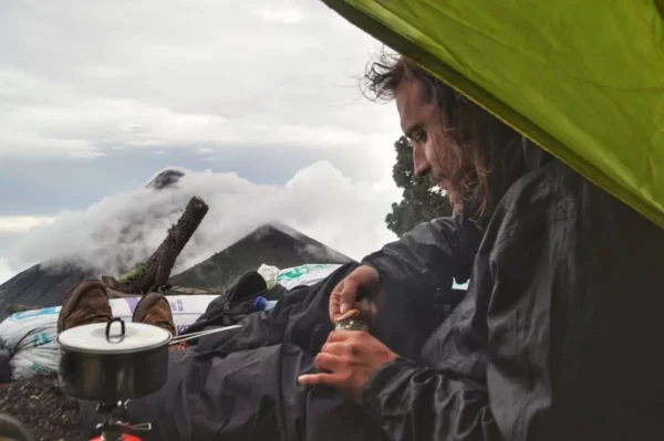
After darkness fell, lines of headlamps dotted the trail down to the col between the two volcanoes. Most guided tours included this short night hike to view Fuego’s crater from its base. We considered going too, but in the end, we preferred to stay cozy by our tent, cook dinner, and enjoy the volcanic spectacle from there.
We stayed awake till late, captivated by the crescendo of the geological performance. Against the clearest, blackest sky, the fiery spitballs hurled by the crater and the lightning bolts cutting through them stood in stark contrast. The sight was simply impossible to get enough of. We barely lay down for two short hours before getting up at dawn.
The Way back over the Summit of Acatenango
Packing quickly—and gathering our half-chewed foodstuffs after a dog scattered them all over while we were asleep—we started toward the summit of Volcán Acatenango. With frequent stops to gape at Fuego’s crater, fully visible above the morning sea of clouds below, it took us about two hours to climb the remaining 400 meters to the top.
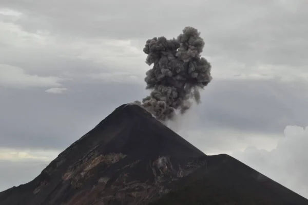
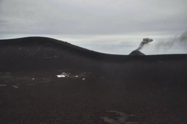
At 3,976 meters above sea level, we found ourselves in an alien setting. The ground underfoot was a mix of scorched black and rust-red gravel, loose and lifeless, as if the earth had only just cooled. No trees, no shelter, just a raw, inhospitable slope under a blank white sky. Everything around us was swallowed in cloud, a glowing void stretching in every direction. Everything, that is, except the crater of Fuego, which hovered above the sea of white like an island of fire in a frozen world—smoking, hissing, alive.

Leaving Fuego’s view to hide once more behind Acatenango’s mass, we charged down the other side at full speed. Before long, we were back on the road. As we waited for the bus and tried to call an Uber at the same time, we also flagged down every passing car, pleading for a ride. A villager and his wife soon stopped and let us hop into the back of their van. They dropped us off in the town of Parramos, where, after a brief stroll around, we caught a chicken bus back to Antigua.
Accommodation & Activities in Antigua Guatemala
Use the map below to search for accommodations in Antigua and beyond, or check out my complete guide on where to stay in Antigua.
Stay22 is a handy tool that lets you search for and compare stays and experiences across multiple platforms on the same neat, interactive map. Hover over the listings to see the details. Click on the top-right settings icon to adjust your preferences; switch between hotels, experiences, or restaurants; and activate clever map overlays displaying information like transit lines or concentrations of sights. Click on the Show List button for the listings to appear in a list format. Booking via this map, I will be earning a small cut of the platform's profit without you being charged any extra penny. You will be thus greatly helping me to maintain and keep enriching this website. Thanks!
Photos
View (and feel free to use) all my photographs from Volcán Acatenango in higher resolution.