Evia (also spelled Euboea – gr: Εύβοια) is the second-largest island in Greece after Crete. Beyond the picturesque, remote beaches that define its long coastline, the vast, 3,684-km² interior of the island is occupied by wild, at times craggy, at times lush, extensive and high mountain ranges. Given also its great vicinity and excellent connectivity to the Greek mainland and Athens in particular, as well as its relative unpopularity amongst tourists, Evia Island makes an ideal destination for the avid adventure-seeker and mountain-lover. If that is you, you may find useful the following list of the eight highest mountains on Evia Island, complemented with useful info, photos, and videos, that I here publish.
Mount Dirfys
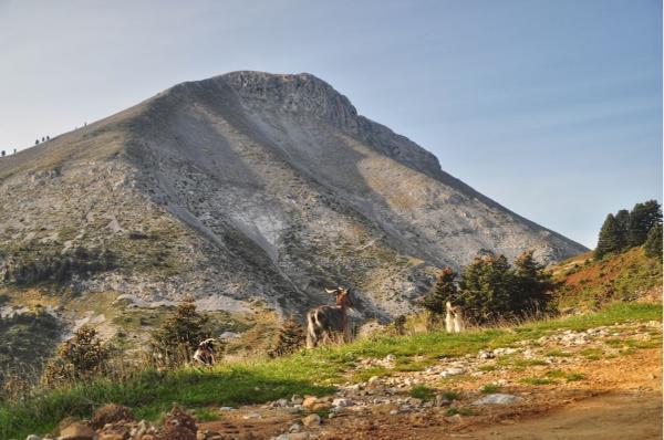
- Altitude: 1,743 m
- Summit coordinates: 38.626627, 23.84106 (Delphi)
- Location: Central Euboea, Dirfion-Messapion Municipality
- Base settlements: Steni, Stropones, Agios Athanasios, Loutsa, Glyfada
Mount Dirfys is by quite a margin the highest mountain on Evia. Its prominent, volcano-resembling cone is imposed on the island’s core in such an impressive pose that all but demands the spectator’s awe. In addition to being its highest point, Dirfys is also the island’s most popular hiking destination by far. Whether taking a strenuous climb to its rugged summit or a leisurely stroll in the ancient woods spanning its lower levels, this mountain is sure to satisfy every excursioner who will undertake the exploration of its numerous trails.
Mount Xerovouni
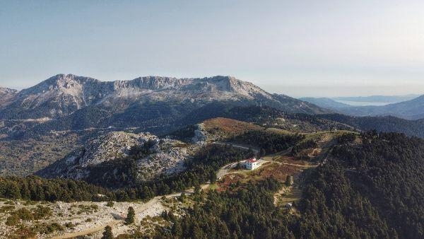
- Altitude: 1,453 m
- Summit coordinates: 38.588869, 23.914812 (Portaris)
- Location: Central Euboea, Dirfion-Messapion Municipality
- Base settlements: Steni, Seta
The second-highest point on the island is claimed by the jagged, dramatic rock formation on the southeastern end of the Dirfys Range. Mount Xerovouni is made by an elevated, sinkhole-pervaded plateau terminating on an impressive, nearly-vertical cliff facing Dirfys summit. Ascents by its cliffside are demanding and offer many climbing opportunities. The terrain on the plateau is extremely rough, and movement over it slow and tiring. Many beautiful forest trails are found all around the mountain’s periphery.
Mount Ochi
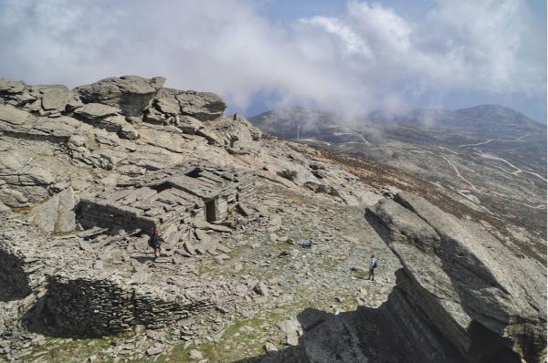
- Altitude: 1,398 m
- Summit coordinates: 38.059958, 24.466584
- Location: South Euboea, Karystos Municipality
- Base settlements: Karystos, Marmari
Throned above the island’s southern portion, Mount Ochi’s name comes from an ancient Greek verb meaning, basically, well, to get it on. That’s so because that’s where Zeus and Hera, Greek mythology’s divinest couple, well, got it on for the first time. The mountain, just like the entirety of south Evia, is mostly bone-dry, even by its foot. But a notable, ancient chestnut forest survives near its top. The mountain hosts a great variety of hiking trails, but what makes it famous are the dragon houses. These are some megalithic structures of unknown origin, with certain theories claiming that they even may be prehistoric. The largest of these is located on the very summit of Ochi, making the trip to it an absolute must for the one pleased to combine trekking with some alternative history.
Mount Pyxarias
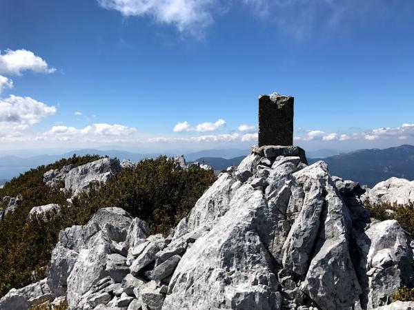
- Altitude: 1,352 m
- Summit coordinates: 38.710729, 23.646371
- Location: North-Central Euboea, Dirfion-Messapion & Limni Municipalities
- Base settlements: Pagontas, Vlachia
Evia’s fourth-highest mountain is also the remotest and least hiked one. Hardly ever do I remember having run into any, even local visitors there. Mount Pyxarias is the northern extension of Dirfys, forming a long continuous ridge all the way north to the plains of Kirevs River. Its highest peak is located about halfway between Pagontas and Vlachia: the two rudimentary, altogether lacking hospitality infrastructure, villages that offer access to the mountain.
Mount Kandyli
- Altitude: 1,246 m
- Summit coordinates: 38.699282, 23.435323
- Location: North-Central Euboea, Dirfion-Messapion & Limni Municipalities
- Base settlements: Limni, Prokopi, Troupi, Nerotrivia
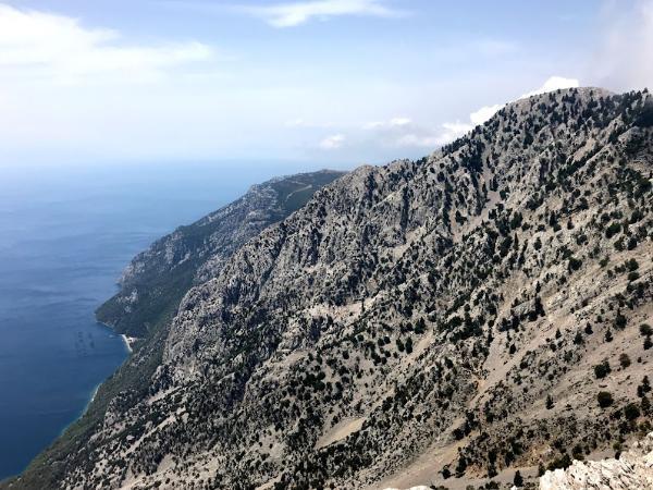
The name of this mountain basically means lantern. It is known like this since ancient times, when it hosted an important fire-communications station on its top. It was probably chosen due to its position right above the sea, allowing for fast message deliveries across the Euboic Gulf. This position is what, still today, gives it its uniqueness, compared to the rest of the island’s mountains. The view of the sea, 1,200 meters below your feet, is epical beyond description. No road or civilization whatsoever spoil the 15-km-long, coastal foot of the mountain, being so, besides a hiking one, an excellent sailing or kayaking destination.
Mount Olympus Euboicus
- Altitude: 1,172 m
- Summit coordinates: 38.478617, 23.865554 (Psili Koryfi)
- Location: Central Euboea, Dirfion-Messapion & Eretria Municipalities
- Base settlements: Eretria, Amarynthos, Theologos
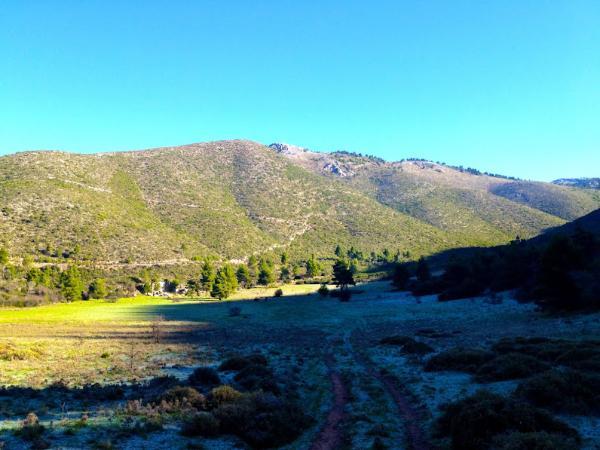
Not to be confused with Greece’s highest mountain in Thessaly, Mount Olympus of Evia has a charm of its own. It is located on the southern coast of the island’s central part, near Chalkis and Eretria. Due to this strategic position of it, it used to be an apple of discord between these two great ancient city-states. Its good accessibility makes it an excellent destination for even a half-day trip from Athens.
Mount Xiron
- Altitude: 990 m
- Summit coordinates: 38.863616, 23.312773
- Location: North Euboea, Istiaias-Edipsou Municipality
- Base settlements: Limni, Agia Anna, Rovies
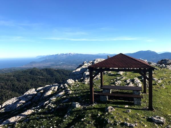
We are moving now to the far north of Evia Island to get acquainted with its seventh-highest mountain. Mount Xiron is rather remote and unfrequented, featuring a wealth of hardly-utilized tracks and trails to be explored. A little wooden kiosk is offered for a comfy sit on its highest point. The view of three different surrounding seas from there is outright spectacular. The main trail to the summit begins at Drymonas Waterfall, one of the few on the island to keep flowing in the summer.
Mount Telethrion
- Altitude: 970 m
- Summit coordinates: 38.866671, 23.189715
- Location: North Euboea, Istiaias-Edipsou Municipality
- Base settlements: Edipsos, Oreoi, Rovies
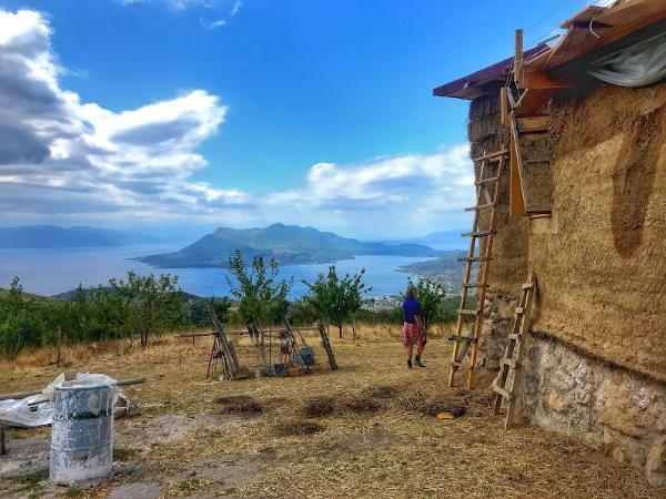
Last on our list is Mount Telethrion. This mountain is located just to the west of Xiron, very close to the island’s more touristically-developed, northern towns, like Edipsos or Istiaia. If you happen to visit the area, you shouldn’t omit to check out the Telethrion Project by Free and Real, an admirable permacultural community established on the western slope of the mountain.
Accommodation on Evia Island
Search the map below to find the best lodges and activities on Evia Island.
Stay22 is a handy tool that lets you search for and compare stays and experiences across multiple platforms on the same neat, interactive map. Hover over the listings to see the details. Click on the top-right settings icon to adjust your preferences; switch between hotels, experiences, or restaurants; and activate clever map overlays displaying information like transit lines or concentrations of sights. Click on the Show List button for the listings to appear in a list format. Booking via this map, I will be earning a small cut of the platform's profit without you being charged any extra penny. You will be thus greatly helping me to maintain and keep enriching this website. Thanks!
