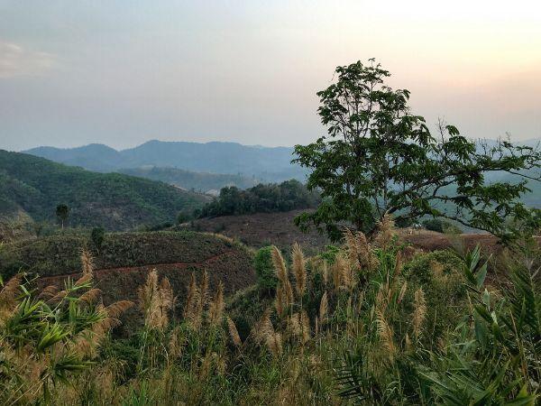
Having plenty of time to explore Northern Thailand, stranded there during the Covid-19 pandemic, for one of our day-trips we chose to check out the Doi Hua Mae Kham Forest Park and the located there Pu Na Go Waterfall.
That is located on the second northernmost point of Thailand after Tachileik border; specifically at the end of a deep ravine intruding into and surrounded by Myanmar. It is 98 km away from Chiang Rai and it took us about 3 hours, together with stops, to drive there on a scooter.

To get there, we followed the motorway from Chaing Rai until Mae Chan. Shortly after the city center, we left the motorway and took a left on road 1130. We remained on that until the village of Ban I-Ko Sam Yaek, where we got onto a smaller road heading up the mountains straight to Doi Hua Mae Kham Forest Park via Ban Therd Thai Village.
This last leg of the trip was scenic beyond description. The road, albeit narrow and remote, was in excellent condition. We drove up and down the gentle mountain slopes, having frequent stops to marvel at the stunning, clear views and take some photos. In Ban Therd Thai, we had a break for a fag at a little wooden kiosk by the road. We were visited by some friendly locals who got curious about our presence.
We drove the last few kilometers up the ravine and arrived in Ban Hua Mae Kham Village by late afternoon. By the entrance of the village, there is a nice porch of sorts overlooking a picturesque slope covered with greenhouses before the distant mountain ridges.
Shortly before the end of the road at the upper side of the village (coordinates: 20.3701, 99.4717), there leaves a dirt road entering the Doi Hua Mae Kham Forest Park. Though rough, the road was overall okay to drive on a scooter. Here and there, we got to stare at some really wonderful views through the openings of the dense vegetation.
A couple of kilometers onwards, we reached the headquarters of Doi Hua Mae Kham Forest Park. The place was utterly deserted; not a soul to be seen. As I later read, the forest park was meant to be shut during the time; apparently due to the Covid-19 outbreak. However, there was no-one on the spot to prevent us from exploring it at will. So we parked the bike and got onto the trail heading down to Pu Na Go Waterfall (trailhead coordinates: 20.3785, 99.4752).
The forest was dense and charming: one of the most proper jungles I have chanced into in Thailand; at times, it was hard to discern the sky through the high treetops. It took us some 15 minutes to reach the falls. The waterfall itself was nothing astounding: just a scant drop of water without a pool to have a dip in. The encompassing forest, however, was of a profoundly enchanting quality. Just a little hidden spot amid crude nature in its wildest manifestation. Anything that happened farther than a hundred meters away felt utterly irrelevant.
We just sat there by the waterfall, listening to the deep message of the jungle’s quiet, until the growing murkiness suggested that the dusk was nigh. It was time to slowly head back.
Accommodation and Activities in Thailand
Stay22 is a handy tool that lets you search for and compare stays and experiences across multiple platforms on the same neat, interactive map. Hover over the listings to see the details. Click on the top-right settings icon to adjust your preferences; switch between hotels, experiences, or restaurants; and activate clever map overlays displaying information like transit lines or concentrations of sights. Click on the Show List button for the listings to appear in a list format. Booking via this map, I will be earning a small cut of the platform's profit without you being charged any extra penny. You will be thus greatly helping me to maintain and keep enriching this website. Thanks!
