Mount Cithaeron is a mountain located north of Athens, of which the highest peak, known as “Profitis Ilias” or “Elatias”, rises to 1409 AMSL. The homonymous, elongated mountain range to which it belongs used to form the boundary between the territories of Athens and Thebes in ancient times; and the border between the Greek prefectures of Attica and Boeotia today.

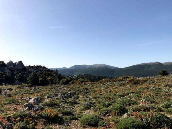
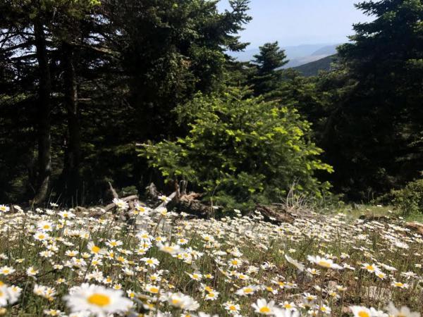
It’s mainly composed of limestone slopes that are exceptionally lush for a south Greek mountain. They are occupied by extensive forests of pines and firs, and various kinds of peculiar mountainous vegetation; and are inhabited by various sorts of notable wild creatures, like foxes and even wolves!

It also enjoys a great deal of fame; with many prominent events of Greek mythology and history associated with it. It was especially sacred to Dionysus’ worshippers, being, according to Euripides, the place where the god of wine with his priestesses were carrying out their occult, ecstatic rituals. It was the site where young Hercules performed his first feat, slaughtering a ferocious lion that resided in the mountain – a common act among his kind of ancient heroes, which led to depriving the out-of-Africa world of those noble animals – receiving in reward the allowance to sleep with all the 50 daughters of the king of Thespiae. It also was the place where baby Oedipus was abandoned and found – fortunately for him and the great ancient tragedians – by a wandering herdsman. Historically, it was the ground of much skirmishing preceding the famous battle of Plataea, the concluding battle of the Greco-Persian Wars, which took place in the plains off the mountain’s north face in 479 BC.
This was the mountain we were bound to conquer that day…
We started driving out of the Greek capital early in the morning. We took the highway to Corinthus until Eleusis; then the road towards Thebes; and finally, some 5 km after the town of Inoi, the small road to Vilia village. Less than a kilometre after passing the village, there is a little park by the right side of the road (38.1698 – 23.3158), right opposite a ravaged building on the left. That’s where we parked the car and took the trail which starts, after about 100 m, off the right side of the road.

The trail is very easy and well-signposted. It first runs along the right side of a shrubby, shallow gully, direction northwest, for a couple of km. By the uppermost end of the gully, where the densely forested peak of the mountain becomes apparent to the west, the trail reaches a narrow meadow and continues ascending to the west, straight towards the peak. After crossing twice a meandering uphill dirt road, the meadow ends together with the view to the peak, as the trail enters a charming fir forest. It soon leads to a narrow col where a refuge is located and the view towards the south appears. That’s where the steepest part of the ascent begins, still through the fir forest, and straight up towards the mountain’s east peak. About half the way to the peak, from there, the trail meets a natural porch hanging off the north face of the mountain and offering a magnificent view of the Boeotian plains.

At about noon, we had made it to the east peak; which is slightly lower than the west one, it is, however, recommended if only one needs to be chosen; as, in contrary to the heavily packed with telecommunications and wind power installations west peak, this is fully pristine.
Having enjoyed the placidity and the great views the east peak has to offer aplenty, it was time to head for the west one. The trail continues along the abrupt, narrow ridge connecting the two peaks, giving you the impression of fluttering across from peak to peak while traversing it. Both the views to the north and south are simultaneously open and absolutely splendid.
Having allowed the time appropriate to enjoy standing on the heavily spoiled-by-human, yet lofty and thrilling summit of Mount Cithaeron, the time was come to return.
Check out this page for more ideas about hiking near Athens or this one for hiking throughout Greece.
Accommodation and Activities in Greece
Stay22 is a handy tool that lets you search for and compare stays and experiences across multiple platforms on the same neat, interactive map. Hover over the listings to see the details. Click on the top-right settings icon to adjust your preferences; switch between hotels, experiences, or restaurants; and activate clever map overlays displaying information like transit lines or concentrations of sights. Click on the Show List button for the listings to appear in a list format. Booking via this map, I will be earning a small cut of the platform's profit without you being charged any extra penny. You will be thus greatly helping me to maintain and keep enriching this website. Thanks!
