Human chatter awoke us at dawn. I went out to inspect. Its source unseeable, it came from within the bordering orchard upslope. White spurts of pesticide jetted above the treeline. We got ready and were off before the fierce morning sunlight reached us.
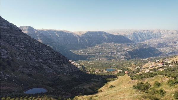
Now we had to climb 400 steep meters until the ridge to rejoin our trail. We started early to avoid doing this in the extreme ulterior heat. But we ran into complications…
In place of the dirt road that the map showed, there was a narrow gully choked with thick, thistly, impassable chaparral. Our sole alternative was to push through the orchards, feet sinking in quaggy soil, scrambling over stone walls that formed the terraces, traversing overgrown ditches, worrying about potential paranoid-of-intruders, shotgun-bearing farmers. Sweaty, sludgy, scratched, we reached another road and soon made it to the ridge.
This story is an excerpt from my book "Backpacking Lebanon", wherein I recount my one-month journey around this fascinating country. Check it out if you like what you're reading.
We sat under a lone little tree to rest and take in a last glimpse of the south view before proceeding down north. All of Aaqoura’s artificial lakes were now visible, reflecting the sky’s immaculate blue from amid the pale grassy slope. A small party from a local hiking club passed and stopped for a chat. They seemed impressed by our intrepid venture and proud of our interest in their region.
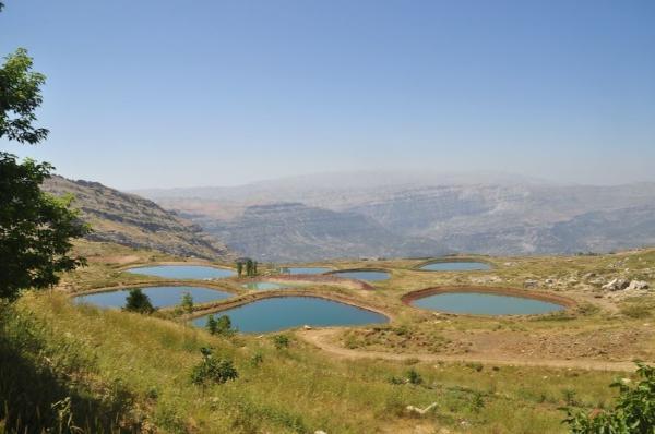
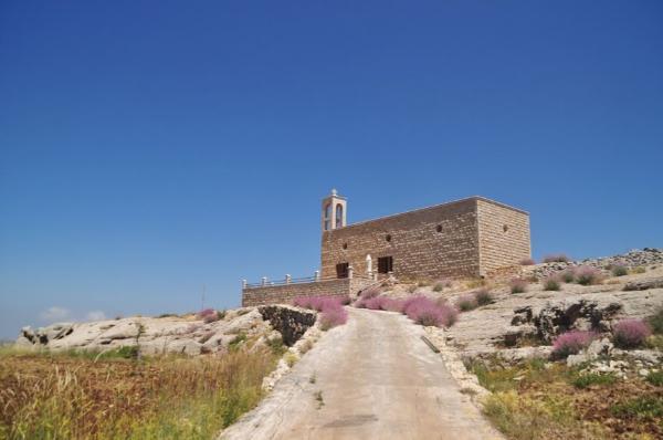
Civilization and plantations were scarcer on the other side of the mountain. The trail was smooth but barely discernible through thick weeds and man-tall wild oats. Two foreign hikers—the first of their kind that we encountered during the trek—were the only humans we saw. Save some solitary houses and an odd, monumental church out in the boonies, we neither saw many man-made structures.
After these few hours of solitude, the tourist crowd at the next valley’s bottom came as a surprise. Preferring the joy of discovery over prior research, we just then became aware that we’d arrived at one of Lebanon’s most awe-inspiring natural attractions.
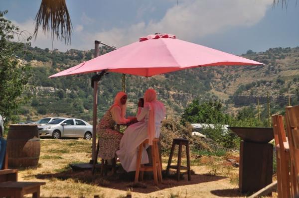
A sweet little outdoor cafe lay by the entrance to the site. We sank into the cushioned seats under a reed canopy to refresh and stimulate ourselves with juice and coffee. A company of French and German tourists sat at the next table. As I went to the bar to order, and I replied to the owner’s question about the country of my origin, one of the German guys came to speak with me in Greek. He had studied classics and his grasp of the language was decent. He must have been famous because people took selfies with him and a burly, bald dude with polarized sunglasses and a spiral-cable earpiece escorted him.
We then paid a $5 ticket, and while folks glided shrieking along a zipline above, we followed a precipitous path ever deeper into the abysmal gorge of Baatara. The path ended on a natural bridge over a seemingly bottomless sinkhole. Above the sinkhole was a rock shelf with a hole through which a waterfall plunged into the chasm. Mosses covered the dull cliffs and embellished the scene with color. This was one of the most extraordinary geological formations I have ever witnessed.
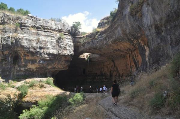
In this fabulous setting, we perched on a ledge beside the void for lunch: flatbread with hummus and a salad made from the fresh vegetables we bought last afternoon. We were going to beef it up with a wild garlic Sophie had plucked earlier on our way, but we providentially thought of double-checking online and discovered that it was a poisonous look-alike in advance instead of during a harrowing antemortem agony.
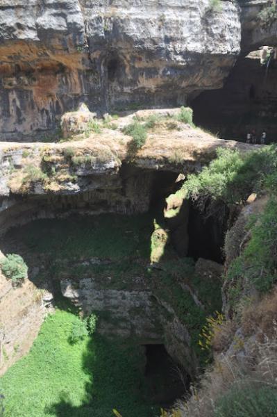
It’d be great to camp there. However, with the waterfall far out of reach, there was no accessible water. An idea was to walk up and around to approach the fall’s source, but since the day had several hours left, we opted to proceed on our route until the next spring.
It was a lovely afternoon hike along the shaded, sylvan slope parallel to the spectacular gorge of Baatara. When we found ourselves above the intersection of it with another gorge, it was getting late, we had found no water, had run out of any we had, and were very thirsty. We could only continue down the steep trail to the bottom where—surely—water would be flowing.
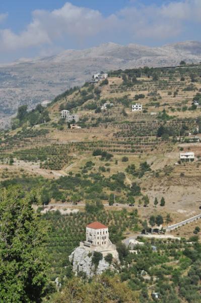
Shrouded in lush woods, bordered by towering cliffs, the gorge junction was the backdrop of a blissful dream. The white shingle of the riverbed, however, was dry as cinder.
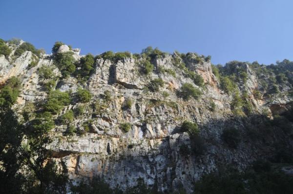
My lips had parched by the time we completed the ascent to the other side. Hanging over the cliff, a village called Chatine lay there. It was small but prosperous, comprising luxuriant villas hemmed in elaborate gardens with fancy cars parked in them. The cobbled streets were rather dead, though. Besides a company of playing kids and a few toiling Syrian gardeners, we encountered but one woman who spoke English and confirmed that the village had neither a shop nor potable tap water. She kindly changed course to go home and give us a big bottle. We’d have to do with that. It wouldn’t suffice for cooking, but it would keep us hydrated.
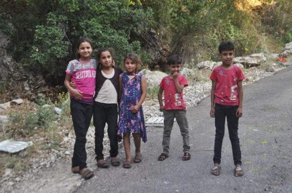
Accompanied by a gang of Syrian refugee children, who spotted us from atop a rock and bolted to us whooping as if they’d seen Dumbo the Flying Elephant in flesh and blood, we walked out of the village. They turned back when the distance exceeded their wandering-allowance radius, and we carried on, still looking for flat ground.
At dusk, we finally settled on a narrow, stony, uncultivated terraced plot. We dined on plain cherries to save bodily fluids and hit the hay.
Photos
View (and if you want use) all my photographs from Aaqoura, Baloue Balaa, and Chatine.
Accommodation and Activities in Lebanon
Affiliation disclosure: By purchasing goods or services via the links contained in this post, I may be earning a small commission from the seller's profit, without you being charged any extra penny. You will be thus greatly helping me to maintain and keep enriching this website. Thanks!
Stay22 is a handy tool that lets you search for and compare stays and experiences across multiple platforms on the same neat, interactive map. Hover over the listings to see the details. Click on the top-right settings icon to adjust your preferences; switch between hotels, experiences, or restaurants; and activate clever map overlays displaying information like transit lines or concentrations of sights. Click on the Show List button for the listings to appear in a list format. Booking via this map, I will be earning a small cut of the platform's profit without you being charged any extra penny. You will be thus greatly helping me to maintain and keep enriching this website. Thanks!
