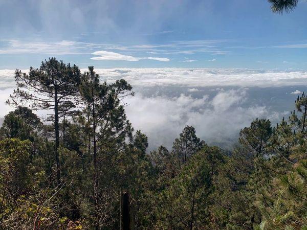
Celaque National Park is located in southwest Honduras, near the historic town of Gracias. It contains the country’s highest peak, Cerro Las Minas, which reaches 2,849 meters AMSL of elevation. The entire mountain, including the summit, is covered by dense, alluring cloud forest. Besides its astonishing flora, it hosts significant fauna, including endemic species and wild felines such as pumas and jaguars. Having recently entered Honduras, it became our obvious target for a trekking adventure.
Mount Celaque features numerous trails leading to various peaks and waterfalls and places. But we chose a rather short and straightforward route going to its top. It took an 8.5 km trek with 1.5 km of ascent to reach Cerro Las Minas from the trailhead. The round trip can easily be completed in one somewhat long day by a reasonably fit person. But we chose to overnight and duly enjoy the magic of the woods.
Affiliation disclosure: By purchasing goods or services via the links contained in this post, I may be earning a small commission from the seller's profit, without you being charged any extra penny. You will be thus greatly helping me to maintain and keep enriching this website. Thanks!
Morning, we left our hotel in downtown Gracias and stopped the first passing-by tuk-tuk. The driver asked for 150 lempiras to bring us to the trailhead. I bargained it down to 130 and still thought of it as unreasonably expensive for the mere 6 km to the national park entrance. But then I found out it was a rather ok price. I had the impression we’d drive only as far as the gate, but it turned out we could carry on for a couple of extra km of steep dirt road up to a visitor’s center.
We each had to pay 120 lempiras for the entry fee plus 100 for camping. Although they seemed a little bewildered, they had no problem with us trekking without a guide.
The first part of the trail ran along a river, whence some views of the mountain appeared. We then penetrated the forest and saw little more than sheer green for the rest of the trip. It was, however, a delightful green. Thick foliage of soaring trees concealed every patch of sky; vines, mosses, and myriad forms of vegetation covered all surfaces available… Definitely one of the most charming forests I’ve ever witnessed.
The whole trail was obvious and well-signed; little chance of anyone getting lost. It had some steep sections here and there, but it was fairly smooth for the most part. Running water was plenty en route.
There are two camping areas: 1) Don Tomas (coordinates: 14.5508, -88.6597), and 2) El Naranjito (coordinates: 14.5475, -88.6697). The second is the best choice; it’s much closer to the summit, for one thing, and also has water and amenities such as benches, tables, and (in our case) piled firewood.
We pitched our tent, lit up a few indispensable mosquito coils, and settled for the night. We were soon joined by a group of local hikers who had followed after us. I asked their guide about the pumas, and he said that, after all his years, not even he has ever seen any with his own eyes; they have only managed to decoy them with meat and record them on installed cameras while no human is around. Shy creatures those cats.
We were planning to get up and start before dawn. But of course, we snoozed on well into the morning. Leaving the tent with most of our stuff down, we climbed light. Although it rained a little, the sun shone above the canopy near the top. From a little wooden porch a bit below the summit, we could at last wonder at some nice views out of a clearing.

Same way down, we were back at the visitor center in the afternoon. To our great luck, a car was about to depart for Gracias and gave us a ride, saving us from the trouble of walking further and hitchhiking or somehow calling a tuk-tuk.
Photo Gallery
View (and if you want use) all my photographs from Celaque National Park.
Accommodation and Activities in Honduras
Stay22 is a handy tool that lets you search for and compare stays and experiences across multiple platforms on the same neat, interactive map. Hover over the listings to see the details. Click on the top-right settings icon to adjust your preferences; switch between hotels, experiences, or restaurants; and activate clever map overlays displaying information like transit lines or concentrations of sights. Click on the Show List button for the listings to appear in a list format. Booking via this map, I will be earning a small cut of the platform's profit without you being charged any extra penny. You will be thus greatly helping me to maintain and keep enriching this website. Thanks!
